THE MANZANO CABLE
 The Manzano cable was a 10,477 metre system of cabling serving many mines in Bacares and Las Menas.
It was owned by The Bacares Iron Ore Mines Limited (the 'English' ).
The first section built was from Serón station 1,848 metres to Las Lomillas. The second section was 3,553 metres from Las Lomillas to 'El Empalme'. From here the 305 metre cable to Manzano was built, being followed by La Leona, Santa Catalina, La Pastora, Tachuela and finally, Las Menas, 2,610 metres.
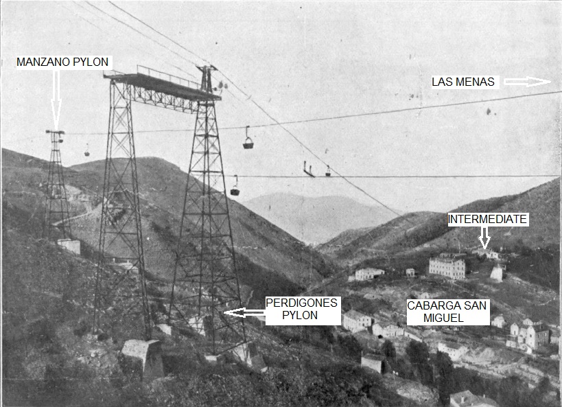
It can be seen from the photograph that there was a complexity of cabling, especially in the Las Menas area.
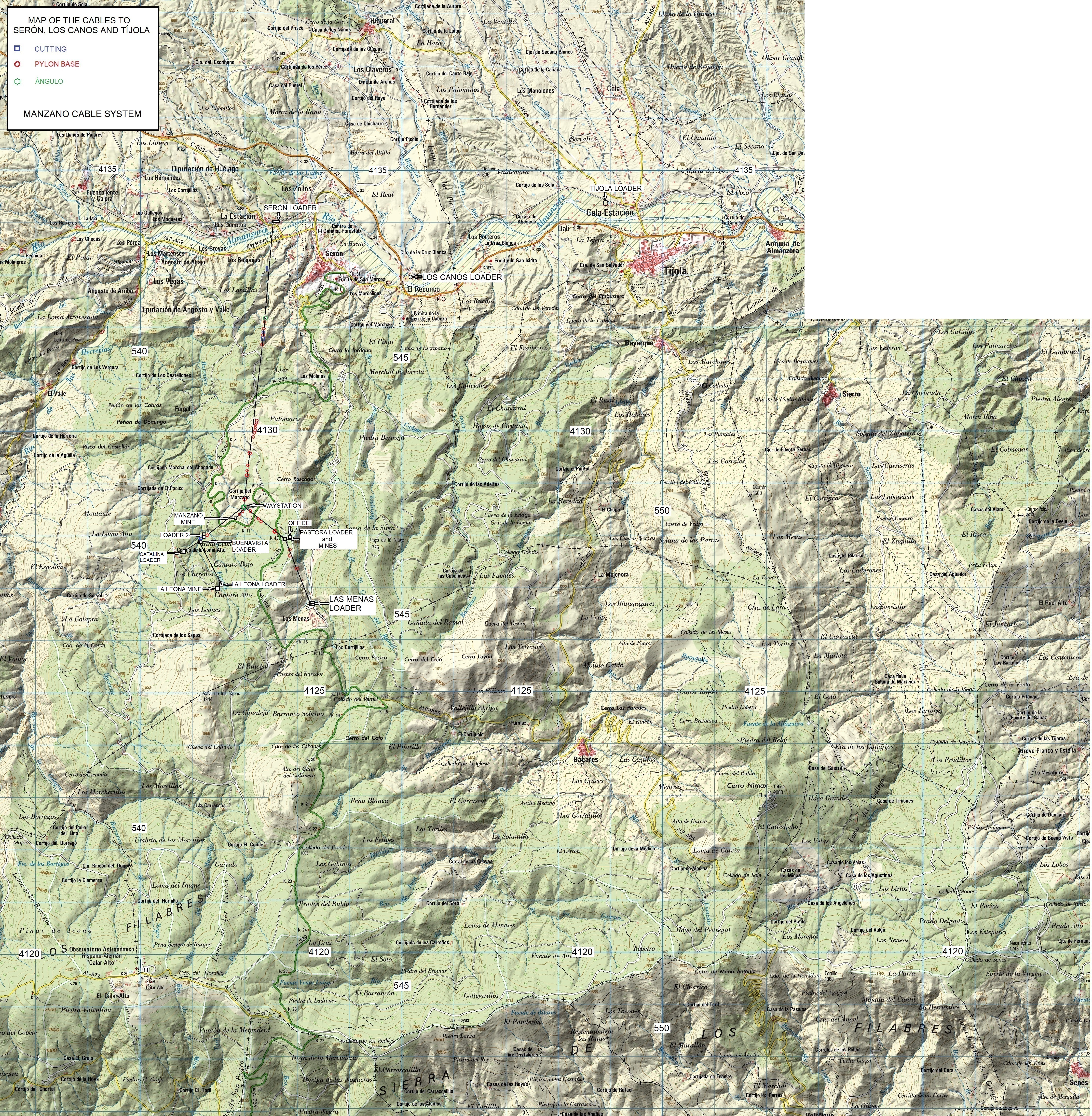
See also the map produced by Miguel de Vicente.
The cable used was the Roe monocable manufactured by Ropeways Limited. This steel cable was 26 - 27mm diameter, made up of six cords each of seven 3mm strands wrapped around a central hemp core.
Distances are as follows:
| Station | Height ASL (metres) | Distance (m) |
|---|---|---|
| Serón loader | 784 | 0 |
| 'Estación Divisoría' | 976 | 1,836 |
| Braking station | 1,167 | 3,249 |
| Mid-way waystation | 1,374 | 5,389 | Manzano loader | 1,336 | 5,693 |
| LOS LEONES BRANCH | ||
| Midway station | 1,374 | 5,388 |
| Buenavista loader | 1,341 | 6,646 |
| Los Leones loader | 1,444 | 7,313 |
| LOS LEONES - LAS MENAS BRANCH | ||
| Midway station | 1,374 | 5,388 |
| La Pastora loader | 1,499 | 6,410 |
| Las Menas loader | 1,524 | 7,998 |
| SANTA CATALINA BRANCH | ||
| Buenavista loader | 1,341 | 6,646 |
| Santa Catalina loader | 1,363 | 6,880 |
| CORTIJUELO CABLE | ||
| Serón loader | 784 | 0 |
| Braking station | 1,056 | 3,263 |
| 'Angulo' station | 1,190 | 3,880 |
| Perdigones loader | 1,446 | 7,237 |
| Braking station | 1,600 | 8,162 |
| 'Angulo' station | 1,657 | 9,464 |
| Cortijuelo loader | 1,498 | 11,434 |
| LAS MENAS BRANCH | ||
| Perdigones loader | 1,446 | 7,237 |
| Las Menas loader | 1,524 | 7,732 |
| CORTIJUELO - FRANCIA SECTION | ||
| Cortijuelo loader | 1,498 | 11,434 |
| San Ignacio loader | 1,564 | 12,100 |
| Francia loader | 1,670 | 13,194 |
The GPS data are in two different formats. The second is the Spanish grid system which aligns with the map. If you have a Garmin etrex then it should be set as follows:
POSITION FRMT: UTM/UPS.
MAP DATUM: NAD83.
UNITS: METRIC.
NORTH REF: TRUE.
Click on a point on the map below. Blue squares are cuttings, red circles pylon bases. The cable is in the centre of the map and can be found by moving the map up and to the left.


