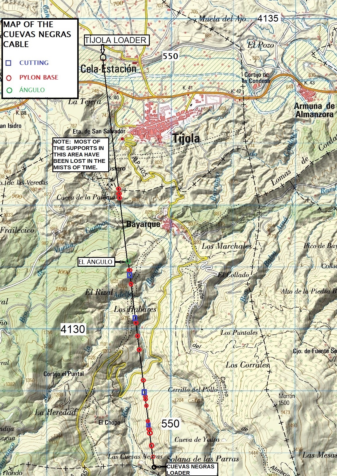

The Cuevas Negras cable carried iron ore down the the Tíjola loader up until 1909 when the mine was exhausted. See Cuevas Negras mines for more information.
See also the map produced by Miguel de Vicente.
The GPS data are in two different formats. The second is the Spanish grid system which aligns with the map. If you have a Garmin etrex then it should be set as follows:
POSITION FRMT: UTM/UPS.
MAP DATUM: NAD83.
UNITS: METRIC.
NORTH REF: TRUE.
Click on a point on the map below. Blue squares are cuttings, red circles pylon bases. The cable is in the centre of the map and can be found by moving the map up and down. See also a report on the mines.
